
A significant all-hazards severe weather episode is likely to occur across much of the Mississippi Valley from Iowa into Missisippi, and into portions of Illinois. Significant straight-line wind gusts, including gusts up to 90 mph, large hail, and strong tornadoes is expected today, Friday, March 14th. It is imperative that you remain alert for potential watches and/or warnings if you are in the affected areas.
A potential tornado outbreak is possible across much of Mississippi and Alabama on Saturday, March 15th, with the SPC highlighting an unprecidented Day 2 HIGH risk for portions of the area. Violent tornadoes, including some that may be of EF3 strength or higher is possible across the outlook area. Those in the area should prepare for significant severe weather, and prepare to seek shelter should warnings be issued for your area!
Friday (3/14) Update
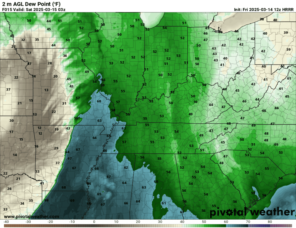
Synopsis: A system will rapidly deepen and overspread across the Ozarks and MS Valley into Friday. An impressive area of near 60-degree dewpoints and impressive southwesterly flow across the region will develop. The combination of the above and modest MLCAPE will set the stage for significant areas of wind gusts, as well as supercellular development farther south into the outlook area. Recent high resolution guidance supports the potential for two sections of the event, each producing its own main risk of hazards.
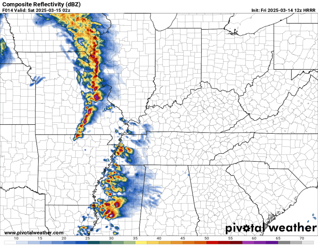
The risk for Friday can be split into two different zones, and while the current outlook remains a wind-driven moderate risk (45% hatched), there remains an impressive 15% hatched risk for tornadoes across much of Illinois all the way into Mississippi. In the northern area, primarily across the St. Louis metropolitan area, and points around it, significant swaths of straight-line wind gusts (some exceeding 80 mph) will remain possible, along with the possibility of large hail (up to baseball sized!). The recent HRRR runs (pictured below) continue to support a bowing segment of linear mode thunderstorms, which commonly produce areas of significant damaging winds.
It’s important to note that while the northern mode will remain mostly linear in mode, there remains the potential for supercells, especially near/south of this line. This would keep a tornadic potential at play for much of the area, and a tornado risk will increase with southern extent.
Further south, significant supercell development is likely into Alabama/Tennessee, and while this is mostly occurring overnight, this is expected to remain a mostly favorable environment for significant severe potential. It’s important to note that forcing may hinder severe thunderstorm development across the southern portions of the outlook area, however any storm that is able to develop will quickly pose a significant risk for tornadoes, hail, and damaging winds.
Saturday (3/15) Update
Synopsis: The focus for Saturday turns towards the Deep South, into much of Alabama, where a significant portion of the area may be at play for significant and violent tornadoes into the night on Saturday. A significant area of mid/upper flow will overspread the region into the forecast area, and will be coupled with quite an intense area of 500mb jet streak. Coupling this with classic Gulf dewpoints into the mid/upper 60s will set the stage to support a significant and widespread risk for severe thunderstorms across much of the Southeast US into early Sunday (3/16).
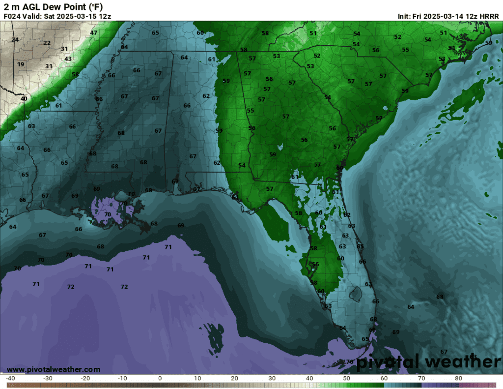
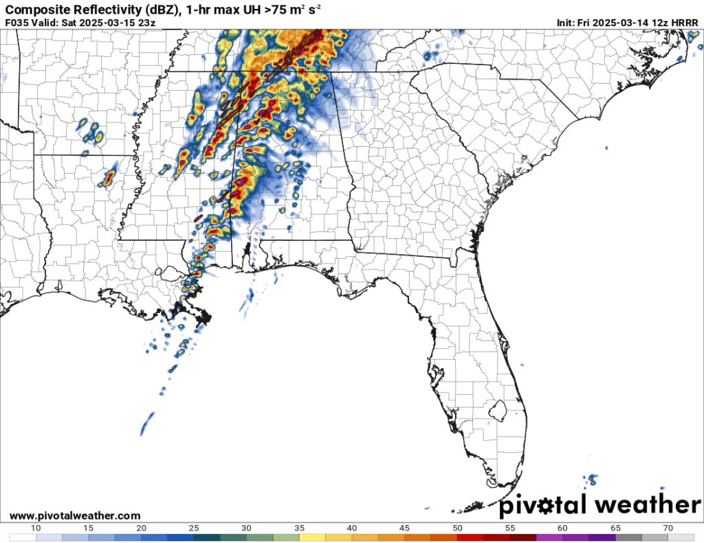
Convective models are now in range, painting quite the significant and potent severe weather episode Saturday. This has prompted an unprecidented Day 2 HIGH risk across much of the area. Bottom line is that significant severe weather is likely Saturday. This is especially true across much of the Deep South, where MLCAPE values approach 2000 J/kg in some spots, and while this number does decrease the further north you go, it’s important to note that this setup remains favorable for intense supercells across the region. The most likely location for tornadic potential remains across much of Mississippi and Alabama.
Further north, into Ohio, a slight risk remains in effect; however, due to precipitation early in the day, there could be some uncertainty into how much clearing (destabilization) occurs in the area. If enough clearing occurs, the main risk in this region would likely remain damaging wind gusts in this area.
Other
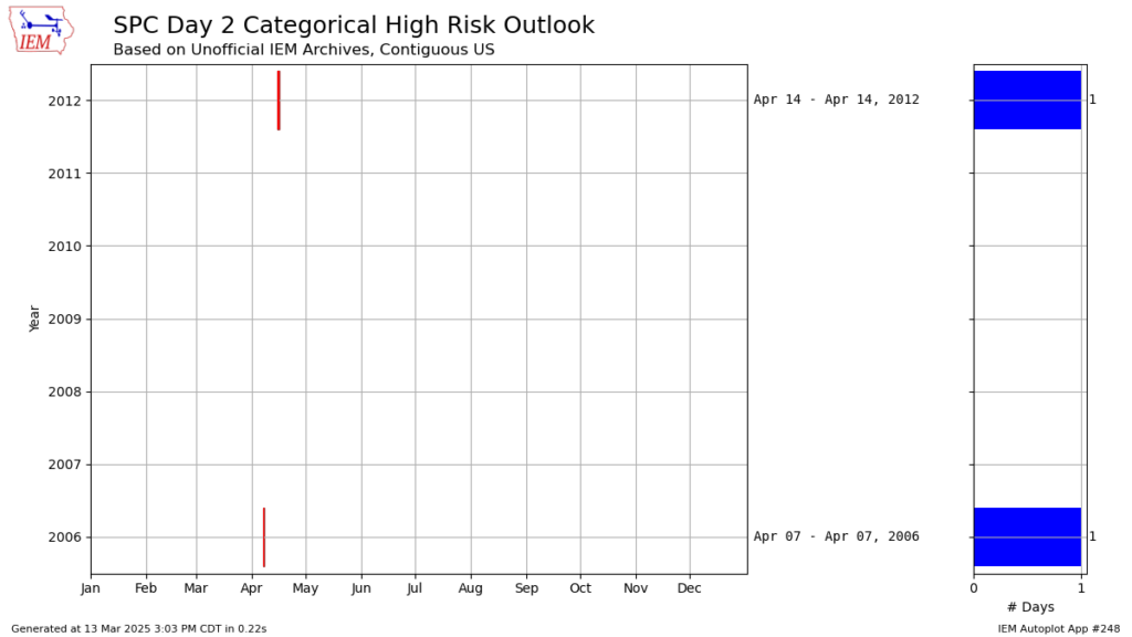
This is the third ever Day 2 HIGH risk ever issued by the Storm Prediction Center. The last two were issued on April 14th, 2012 and April 7th, 2006, as pictured below.
It is important to monitor and prepare for significant severe weather if you are in or around these higher-end risks, and be prepared to seek shelter in a tornado shelter or basement if a warning is issued for your area. Always have multiple methods of monitoring and receiving severe weather alerts, including phone apps, wireless emergency alerts, weather radio or AM/FM stations, and local TV stations. Those inside should never rely on tornado sirens to be alerted to seek shelter.
Prepare a severe weather kit, including helmets! You can find more information about tornado preparations here.
Special Coverage Mode has been activated for this event! Live coverage mode will be available for this event, if necessary.
Our Central Alert Repository is prepared for the influx of severe alerts expected tomorrow. You may also listen to GWES ERN Stations for the relay of these alerts.
Interested in joining GWES? We will be providing coverage and updates on this system throughout the event on our Discord at https://discord.gg/GWES.
Contributions to this forecast were made by the following GWES Forecasting members: Jon, kurt, KRZY, wxtership